Instagram VK VK MAX
Places

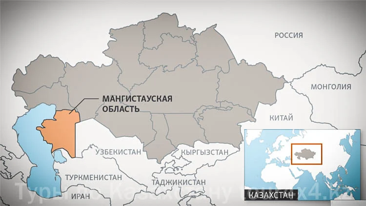
Mangystau. Mangystau Peninsula.

This article offers a brief overview of Mangystau Region and its natural and historical attractions. The text contains links you can follow to see more photos of the places described in it.

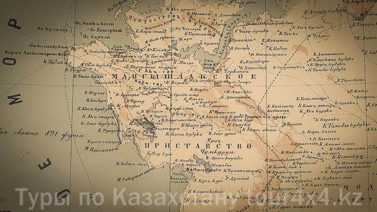
In pre-revolutionary Russia and in the USSR, the largest peninsula on the northeastern coast of the Caspian Sea in western Kazakhstan was called Mangyshlak. Since the early 1990s, the name Mangystau has been used in Kazakhstan. There are several theories about the origin of the name: the first interpretation is that “Mangyshlak” means “winter pasture of the menks” (the Turkic “menk” is the name of one of the Nogai tribes, and “gysh-lak” means “winter pasture”); the second interpretation is that “man” means “sheep” and “gyshlak”, i.e. “a sheep wintering ground, a sheep winter pasture”; and the third derives it from the corrupted “min kishlak” — a thousand villages, kishlaks. Mahmud al-Kashgari (11th century) offered his own etymology: from “man kygylag” — “the land (wintering ground) of the Man people”.
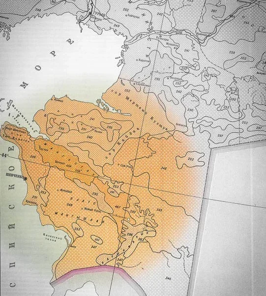
The Mangystau Peninsula is a projection of the Mangyshlak Plateau, eroded and cut in different directions by deep ravines. The shores here are steep, in places absolutely sheer. The peninsula juts into the sea for approximately 250 km. The elevations of the mountainous part of Mangystau reach 555 m, and up to 278 m on the plateau. Most of the territory of the region is occupied by a wormwood and salt-marsh desert with patches of shrub vegetation. The soils are of the semi-desert type; parts of the surface are covered with sands, salt marshes and takyr-like solonetz. Everything that grows in spring dries up under the scorching summer sun. There are no rivers or freshwater springs here. And powerful winds blow constantly over the deserts, scattering limestone, dry clay and chalk across the area. Mangyshlak means extreme living conditions for humans. The climate is sharply continental and dry. Annual precipitation is about 100-160 mm.

In Soviet times, Mangyshlak was called the “peninsula of treasures”, as this land conceals rich deposits of oil, gas and other minerals. The mineral resources of the region are unique in their diversity, the scale of the deposits and the convenience of their extraction, and have practically no analogues in world geology. Mangyshlak hides many healing springs: bromine, chloride, sodium and others. The peninsula has revealed a richest set of medicinal springs, up to thermal ones that approach in temperature the unique springs of Kamchatka. They were discovered back in the last century, but today only a few — or perhaps just one — are in operation. The sands of Sengirkum, Bostankum and Tuyesu act as a kind of sponge, absorbing the scant precipitation that falls on the peninsula. At the bottom of the vast sand-filled basins, prospectors found pure fresh water. But this water is still not enough. That is why desalination plants were built on the peninsula to supply the city and the region with water: fresh, technical and hot
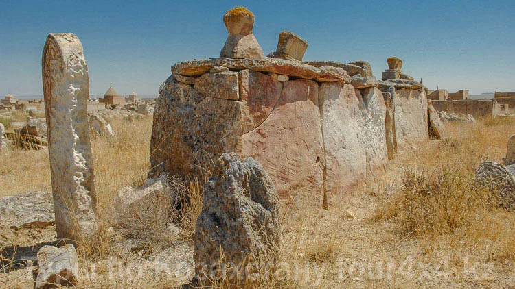
Mangystau Region is part of the most ancient civilization, an open-air archaeological reserve. Archaeologists have discovered numerous monuments of the Paleolithic and Neolithic. In the 1st millennium BC, the Great Silk Road ran across the lands of Mangystau. Along this route on the Ustyurt Plateau stood fortresses and human settlements. Archaeological finds testify that life in the fortresses and these settlements was at a fairly high level. The Great Migration of Peoples and the countless wars associated with it interrupted the Great Silk Road across Ustyurt, and the Mongol invasion finally buried and erased its attributes from the face of the earth. Mangystau Region is home to unique archaeological and historical monuments, including rock-art poems, necropolises and the underground mosques of Sultan-Epe, Beket-Ata, Shakpak-Ata, Shopan-Ata and Masat-Ata.

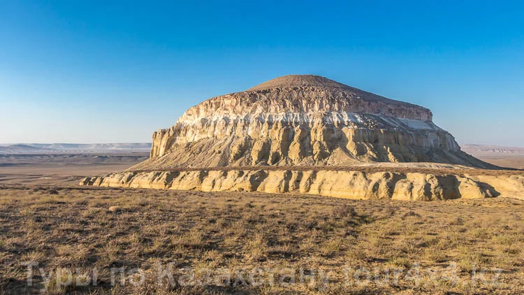
Mount Sherkala is a free-standing mountain in Mangystau Region of Kazakhstan. The height of the mountain is 307 meters. It is composed of chalk rocks, sandstone, clay and limestone. The pillar rocks around the mountain were once part of it, but under the influence of the desert wind they separated from Sherkala over millennia. Climbing to the summit is impossible without special equipment; those who make it will be rewarded with unusual views of the valley in every direction. While walking at the foot of the mountain you can discover traces of ancient settlements and a scattering of stone balls of various sizes. Many have cracked under the action of the wind, and others lie broken. At the foot you can also encounter small tortoises, herds of camels and steppe horses. The first part of the mountain’s name, the word “Sher”, in the modern Kazakh language has nothing to do with either a lion or a tiger and translates as “sorrow” or “longing”. But the second part of the name, “kala”, means city and fortress. There is evidence that Sherkala once served as a fortress — notes from the report of Ivanin I., a participant of a geographical expedition to Mangystau in the mid-19th century, state that during the study of the mountain the skeletons of fallen fighters were found, along with the chain mail of one of the batyrs (warriors), pierced in many places. The mountain became notable for several reasons. First of all, because of its solitary location. And secondly, because of its unusual shape: from one side its outlines resemble a giant yurt, and from the other it looks like a lion lying down to sleep, its head resting on its large paws.

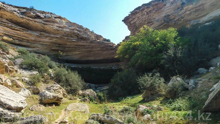
Tamshaly Canyon, located in the northern part of the peninsula 35 kilometers from Fort Shevchenko, is a historical and cultural reserve of the Middle Ages. The picturesque Tamshaly Gorge is known for its small oasis, a waterfall and the freshwater lake beneath it. The oasis is a green valley overgrown with weeping old willows, poplars and shrubs, surrounded by smoky-pale cliffs. The lake has thickets of reeds, chiy grass, mint and blackberries. The water of the waterfall seeps out from under a broad stone platform overhanging like a high cornice. On one side there are sheer cliffs, on the other a gorge leading to the Caspian Sea. The steep slopes of the peninsula in the area of the Tamshaly tract, up to 180 meters high, are a chaotic jumble of destroyed sandstone strata and dense clays. Canyon

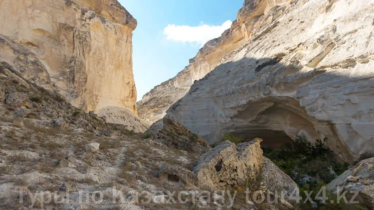
Kapamsay is one of the many most beautiful canyons of Kazakhstan. Kapamsay is a huge, distinctive “corridor” whose walls are sheer limestone cliffs. A narrow and deep river once flowed along the bottom of the canyon, carving up this landscape in its time; now there is an amazing green grove with large trees here. The contrast of the light walls, the whitish salt-covered soil and the emerald-green trees leaves an unforgettable impression.

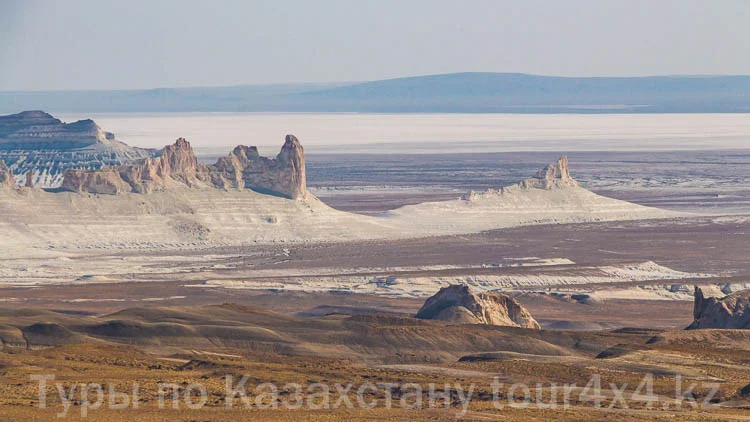
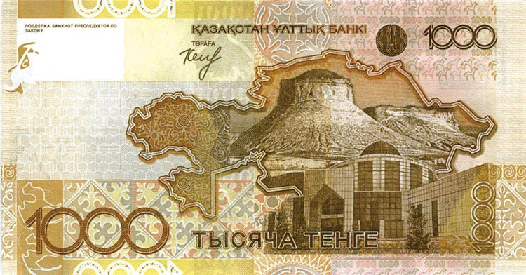
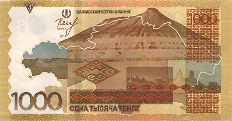
Bozzhyra is the most spectacular valley of Mangystau; it can even be called a rock amphitheater. Over millions of years, sediments and wind have formed landscapes of the most whimsical shapes in the relatively soft limestone rocks: fang rocks, tower rocks, yurt rocks. The name Bozzhyra (boz zhyra) can be translated from Kazakh as “gray ravine”. In reality everything here is light gray in color, and under the brightly shining sun everything transforms into dazzling white. Every Kazakhstani has held a 1000 tenge banknote in their hands, which depicts the rocky ridge of the Bozzhyra valley. And the most surprising thing is that not everyone knew where it is located.

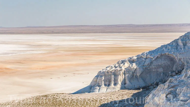
Tuzbair Salt Flat. The western chink of Ustyurt is steep cliffs and cascades of clay-limestone deposits, at the foot of which lies a huge salt marsh, or sor. “Sor” in Kazakh, and “shor” in Turkmen, is a type of salt marsh; a shallow, drainless salt marsh in a depression with a shoreline. It forms as a result of the drying up or lowering of the water level of salt lakes or bays on the bottom of plains basins, as well as of the close occurrence of highly mineralized groundwater in clayey soil. As a rule, a sor forms if the depth of the reservoir does not exceed one and a half meters. The surface of any salt marsh cracks, forming a distinctive pattern called “takyr”. In the dry season the surface of the lake is firm enough to walk on. But you cannot drive across the salt marsh: the crust will not bear the weight of a car and you can get stuck. The snow-white valley of the Tuzbair sor is a stunning creation of nature, a boundless work of its elements. The color palette and shades depend on the time of day: bright white by day, multicolored in the evening. At the foot of the chink of the Ustyurt Plateau, among sheer rocks, cliffs and wide gullies, there is a huge natural arch that is very difficult to reach; only experienced drivers can drive along the very edge of the waterlogged salt marsh.

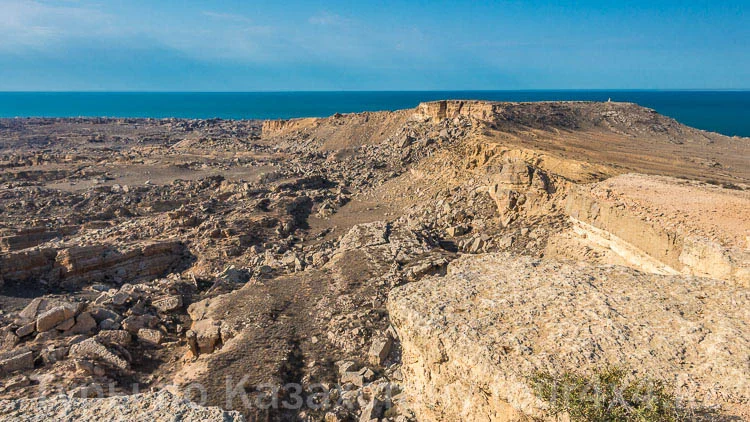
Zhygylgan is a giant ground collapse on the shore of the Caspian Sea. The basin of the depression measures approximately 10-12 km in diameter and is filled with a chaotic jumble of rocks. The sheer walls of the basin rise for several dozen meters. The collapse was formed as a result of a landslide. It is hard to say definitively what could have caused a landslide of such colossal size — an earthquake, or erosion of the ground by the sea. This area has a second name, “Fallen Earth”. At the bottom of the basin numerous historical artifacts have been found: the ruins of fortresses, rock art and fossils of animals.

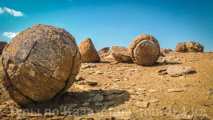
Valley of Stone Balls. The Mangystau Peninsula is home to several mysterious valleys filled with stones of various sizes and spherical shape. The valleys with stone balls of Ayrakty and Torysh are very famous. Part of the stone formations that stayed in the ground longer has been preserved in good, undamaged condition. And the part that spent the most time on the surface of the earth has been destroyed by precipitation and wind. These partially destroyed stones have revealed what they look like inside. As it turned out, each stone has a core around which its larger main part forms. There are several theories about the origin of these mysterious stone formations, but an exact explanation covering everything is not yet known. One can only guess: “What made these stones spherical, and how?”

Below is a link to a detailed description of the tour-excursion in which you can visit the Mangystau Peninsula. Mangystau is one of the most beautiful places in Western Kazakhstan; it is filled with unique natural and historical attractions. Have pleasant travels and unforgettable impressions!

Kazaktourism.com

Ready for an unforgettable tour?