The history of the formation of the Tamgalytas complex is closely connected with the era of the highest military-political might and cultural flourishing of the Dzungar Khanate (1635-1757), which was accompanied by the intensive spread of the Lamaist form of Buddhism among the Western Mongolian tribes – the Oirats.
The natural landscape of the tract played the decisive role in choosing the site and organizing the space of the cult complex; its dominant feature is a rocky massif at the foot of which images and inscriptions from different periods are concentrated on 15 separate boulders. Based on the iconography of the depicted figures, the paleography of the texts and the technique of their execution, four stages in the formation of the complex can be distinguished.
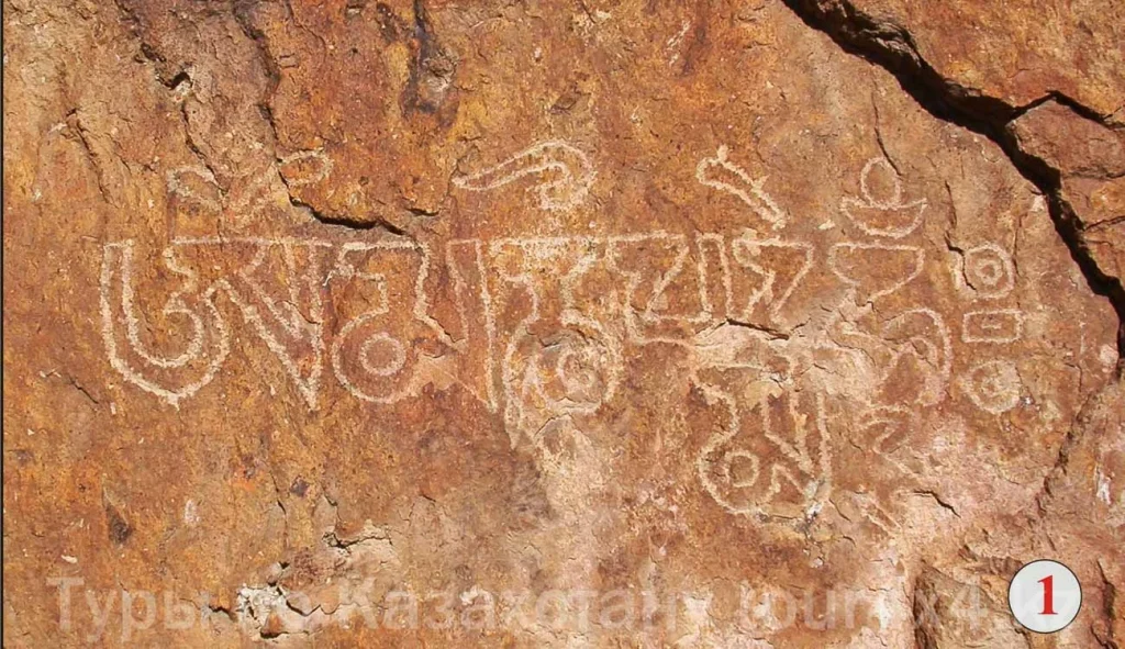
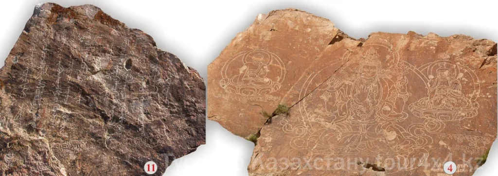
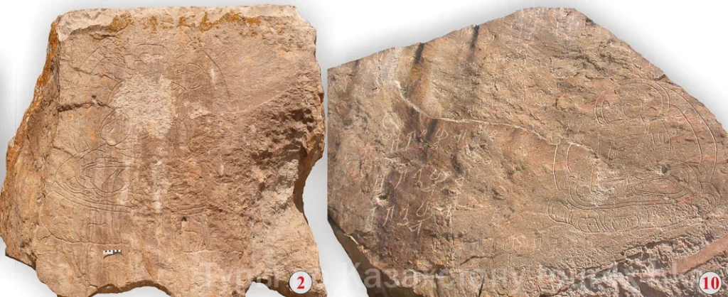
At the first stage, an ensemble was created that included images of Buddha Shakyamuni, the bodhisattva Avalokiteshvara in the form of a “one-faced and four-armed” deity, and Buddha Bhaisajyaguru with accompanying Tibetan inscriptions on the central panel (plane No. 4), a figure of Buddha Nageshvararaja (No. 2), as well as various prayer texts, including two mantras of Buddha Manjushri, whose image is absent from the monument, an address to the Panchen Lama Choizhi Zhalsan (No. 11) and four six-syllable mantras “omma ni padme hum” carved on different rocks around the periphery of the rock pile (No. 1, 5, 13, 16).
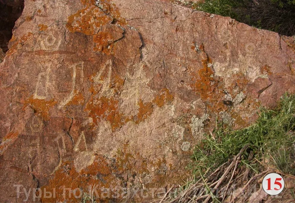
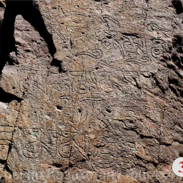 The second stage in the formation of the cult complex is associated with the creation of ten identical texts of the six-syllable mantra, executed in the Oirat “clear script” (No. 10, 13–15, 17). Simultaneously or slightly earlier, the pictorial array of the sanctuary was supplemented with an image of Buddha Amitabha (No. 10), around which a new cycle of Tibetan epigraphy later took shape.
At the third stage, a mantra dedicated to Amitabha appeared next to his image, and on different facets of the nearby rocks – a series of Tibetan inscriptions, including the six-syllable mantra repeated three times (No. 7, 9, 10), the inscription “…Glory to the lama of the good mind… knowledge and mercy…”, addressed to Buddha Shakyamuni (No. 8), as well as two mantras of Manjushri on the southern periphery of the sacred area (No. 17).
The final, fourth stage of the formation of the complex was the creation of the longest text in Tamgalytas, reproduced in 11 lines in the cursive “clear script” (No. 11); in N. S. Yakhontova’s modern translation the text contains a thankful address to the Buddhas and the bodhisattva depicted here for “the overcoming of danger [ranging] from disease to famine” (Oirat. zuda; Kaz. jut) and the wish to attain “in this land a beautiful tranquility, lasting and unceasing”.
The most probable date for the emergence of the early images and inscriptions in Tamgalytas is the period from December 1676 to March 1677 – the time when the nomadic camp (urge) of Galdan Khong Taiji (years of life 1644 – 1697) stayed in the Ili Kapshagai, after his sole power had been effectively established in Dzungaria and on the eve of his official investiture on June 30, 1678 by the Dalai Lama Lobsang Gyatso with the title of Galdan Tenzin Boshogtu Khan (“the Blessed Khan of the Faith, Pillar of the Teaching”). The personal involvement of the new Dzungar ruler in the creation of the sanctuary is confirmed by the presence here of an image of the bodhisattva Avalokiteshvara, whose emanation, from 1660 onwards, was considered to be the Great Fifth Dalai Lama (1635-1682), as well as by a dedicatory inscription bearing the name of the high-ranking Tibetan hierarch Choizhi Zhalsan – Galdan’s spiritual mentor, under whose guidance he received a theological education in Tibet over the course of 12 years. The establishment in Tibetan iconography of the image of the bodhisattva Avalokiteshvara-Shadakshari in the form of a “one-faced and four-armed” deity, represented in Tamgalytas, dates to the 1660s; in the territory of the Dzungar Khanate this canonical image began to be reproduced in painting, sculpture and monumental art no earlier than the last quarter of the 17th century, with the establishment of Lamaism among the Oirats.
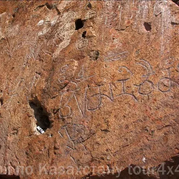 Galdan’s creation, on the riverside cliffs of the Ili, of an impressive panorama combining the images of the most venerated deities of the Tibetan pantheon served as a political manifestation of unswerving loyalty to the teachings of Tsongkhapa and of readiness for their active spread in the northwestern part of Central Asia. The choice of the site for the Buddhist sanctuary was determined by the expressive qualities of the picturesque landscape and by its location near one of the main river crossings of the Ili Kapshagai.
The pictorial array of the Tamgalytas sanctuary took its final shape during the first two stages, no later than the first half of the 1680s. In this period the Kapshagai tract, with its three river crossings of the Ili, acquired particular importance in connection with the large-scale campaigns of conquest undertaken by the Dzungar rulers in Southern Kazakhstan and Central Asia. For more than half a century the area of the Ili Kapshagai remained a pivotal point of the Oirats’ interregional communications, and the fords across the Ili played an important role in the political integration of the Oirat tribes and in the spread of the Buddhist teaching across the territory of the Dzungar Khanate.
Worship by the Buddhist Oirats continued during the next stage of the sanctuary’s functioning, which covers the reigns of Khong Taiji Tsewang Rabtan (1698 – 1727), Galdan Tseren (1727 – 1745) and their successors, characterized by the undisputed dominance of the Gelugpa school in the religious and spiritual life of the nomadic Oirats and by the wide adoption among them of their own script – “todo bichig” (the clear script). A series of prayer inscriptions, executed with varying degrees of skill and addressed to the Buddhas Shakyamuni, Amitabha and Manjushri, records a stage of active visitation of the cult site. The appearance of the Mongolian toponym Tamga in the oral vocabulary of the Oirats of Semirechye should also be attributed to the same time; it came to designate the area where the sanctuary founded by Galdan Boshogtu Khan stood, as well as the adjacent territory, including the nearby ford across the Ili. Lamaist visits to the sanctuary ceased around 1758, after the fall of the Dzungar Khanate under the blows of the troops of Qing China and with the return of the Kazakh and Kyrgyz clans to the lands of Semirechye.
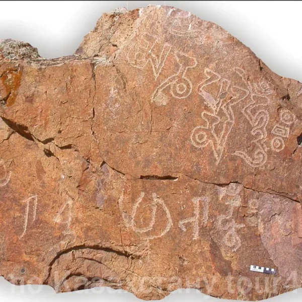 The final stage in the creation of the cult epigraphy of the Tamgalytas sanctuary is connected with the culminating episode of the “last great migration” of the Volga Kalmyk Torguts, led by Ubashi Khan in 1771 from the bounds of Russia to the lands of the former Dzungar Khanate. Having crossed the Yaik River in mid-January 1771, the Kalmyks advanced across the lands of Kazakhstan for six months, almost continuously fighting off attacks by the armed detachments of the Kazakhs of the Junior Zhuz, and then by the united militia of the three Zhuzes led by Khan Nuraly and Sultans Ablai and Abulfeiz.