



3. The Archaeological Complex
(A. E. Rogozhinsky)
The fertile valley of the Koksu River and the surrounding mountainous periphery, rich in herbaceous vegetation and well supplied with moisture, have from ancient times been an area exceptionally favourable for human habitation. Numerous archaeological monuments and the ubiquitous traces of the modern anthropogenic impact on the landscape testify to the active use of the territory over the last three millennia. The rich natural resources of the area, together with the specific conditions of relief and climate, made agriculture and cattle breeding especially promising here, creating the prerequisites for a settled way of life of the population.
The archaeological monuments of the area are represented by dozens of settlements and burial grounds, metallurgical workshops and petroglyph sites, dating from the Neolithic (?) and the Bronze Age to the Middle Ages and the Modern period inclusive. At present, the monuments of the right bank of the Koksu River and of the western part of the Yeshkiolmes Ridge remain the better studied.
Within the depression and on its periphery, several areas of concentration of monuments of different kinds and historical epochs have been identified, grouped in a certain way in the landscape. Two main zones of the location of monuments are clearly distinguished: the zone of the depression and the mountain-foothill zone.
The first is characterized by the predominance of large settlements and burial grounds of various epochs, among which stands out a series of “royal” kurgans of the Early Iron Age occupying a dominant position on the high sections of the ancient loess plateau. Along the tributaries of the Koksu River are concentrated settlements, usually located on the upper terrace or on the surface of the loess plateau. The mouths of the tributaries in the southern part of the depression are especially rich in monuments; large settlements have been discovered here, containing cultural layers of the Bronze Age, the Early Iron Age and the Middle Ages. In general, the monuments of the intermontane depression characterize a high degree of economic development of the territory from ancient times to the present.
The monuments of the mountain-foothill zone comprise burial grounds of different periods, confined mainly to alluvial fans, small camp-settlements concentrated along the watersheds and in the wide mouths of the erosional valleys, as well as petroglyph sites.
In the eastern part of the depression, in the area of the Begash and Zhalgyzagash settlements, a large group of monuments has been identified – settlements, burial grounds and rock images of the Bronze Age and later periods. Here, too, on the foothill sections of the loess plateau, isolated artefacts of Neolithic appearance have been found (Aubekerov, Nigmatova, Frachetti, 2003, pp. 288–289).
The area of the highest concentration of monuments of the mountain-foothill zone covers the western part of the Yeshkiolmes Ridge and its southern slopes up to the watershed. Along the watershed line are concentrated the kurgan burial grounds apparently belonging to the culture of the ancient and medieval nomads. In the upper reaches of the gorges, in the widened sections of the hollows, there are permanent camp-settlements of the 19th – early 20th centuries; at some settlements ceramics of the Early Iron Age and the Middle Ages have been found. Near the camps there are small series of petroglyphs and Kazakh inscriptions, including those in Arabic script.
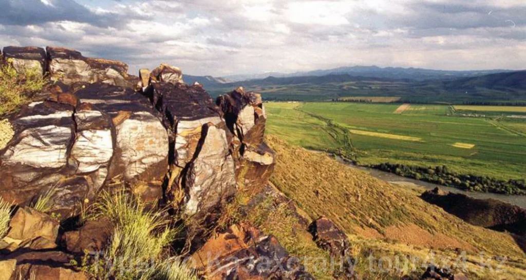
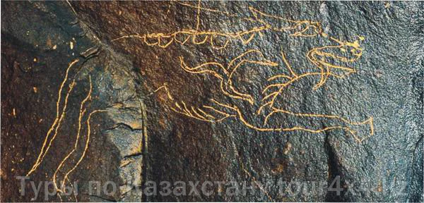
The largest petroglyph sites are located in the middle parts of the erosional valleys, on strongly patinated sandstone outcrops, whose exposures are confined to the crests and slopes of the deep gorges (Figs. 33, 35). Particularly large and significant petroglyph sites have been discovered in gorges 10, 12–14 and 18 (according to the indexing of A. N. Maryashev and A. A. Goryachev; 2002, Fig. 93). More than 50% of the petroglyphs of the Yeshkiolmes Ridge are concentrated here, among them the most representative subjects and images of the Bronze Age, the Early Iron Age and the Middle Ages. Petroglyphs are practically absent on the rocky and precipitous slopes of the tectonic ledge; the rocks here are also covered with patina, but the substrate, which includes pebble conglomerates, is almost unsuitable for creating images.
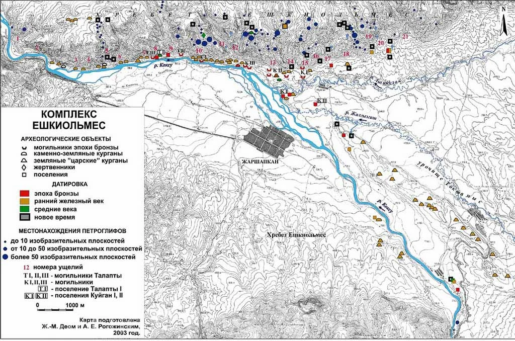
The next group of monuments of the area is formed by the burial grounds and settlements concentrated along the ledge of the Yeshkiolmes Ridge. Over a distance of 6-7 km from the bend of the Koksu River to the west to the antecedent section, more than ten burial grounds and several settlements of different epochs are located almost in contact with each other. Strong bank erosion is currently destroying many of the monuments located at the mouth of the Ashchibulak River (the Kuigan I settlement) and on the narrow terrace of the Koksu River, at the foot of the ridge. The modern shoreline in places is only 30-50 m away from the mountains, and the destruction has to some extent affected both the monuments of the Bronze Age and those of later epochs. The kurgans of the Early Iron Age are organized in chains stretched along the river bank. The largest kurgan burial grounds are located on the section of the terrace between gorges 5 and 9, but within the canyon on the right bank no ancient monuments have been found.
The monuments of the foothills of Yeshkiolmes belong to different historical periods, the oldest of which date to the Bronze Age.
The Talapty I settlement occupies a comparatively wide preserved section of the terrace, bounded on the east by a powerful alluvial fan at the mouth of gorge 9. On the surface of the site a large number of whole and fragmented stone articles has been collected – hoes, querns, pestles. In the Bronze Age, in the western part of the site, the Talapty III burial ground and a settlement successively existed (Goryachev, 1997, pp. 20-21). The dating of the two dwellings studied here (10th-9th/8th centuries BC) is established on the basis of: the construction of the semi-subterranean structures and the main ceramic complex of the Dongal type; the stemmed arrowheads with a shoulder – bone replicas of bronze articles (Yakke-Parsan 2); the bronze sickle-shaped implement (type G1, after N. A. Avanesova; 1991, p. 21, Fig. 19, 32); the stone whetstone with a groove for suspension (Potapov, 2003, p. 121). On the opposite, eastern, side of the settlement, in 2003, a surface-type structure (dwelling 3) was partially investigated, containing ceramics of a more archaic appearance (thick-walled, polished, decorated with fluting and the impressions of a fine comb), which has similarities with the pottery from the Talapty II burial ground.
The Talapty II burial ground is located approximately 500 m to the east of the settlement, on the opposite bank of the erosional valley (gorge 9). The preliminary dating of the monument (13th-12th centuries BC), for the most part excavated in the 1980s (Maryashev, Karabaspakova, 1988, pp. 32-38), is determined by: the tubular earrings of bronze and gold plate, the wire earrings with a spiral coil ending in a disc (type D1, after N. A. Avanesova; 1991, pp. 56-57), as well as a homogeneous ceramic complex whose proportions and partly the ornamentation of the vessels are similar to the materials of the Andronovo (Fedorovo) monuments of the Minusinsk Depression and the steppe Altai. A cultural connection with the monuments and population of Southern Siberia of the Bronze Age is also evidenced by the features of the burial structures, the burial rite and the anthropological type of the buried individuals of the Talapty II burial ground (the South Siberian type of the Caucasoid race, according to a preliminary conclusion of O. I. Ismagulov; Maryashev, Goryachev, 1993, p. 16). Thus, in the western part of the foothill area of Yeshkiolmes a cultural complex of the Late Bronze Age is distinguished (dwelling 3 of the Talapty I settlement and the Talapty II burial ground), as well as a settlement of the final stage of the Bronze Age (dwellings 1 and 2). The final stage of the ancient use of the section of the terrace where the Bronze Age monuments are located is connected with the formation of a kurgan burial ground apparently belonging to the Early Iron Age and the Middle Ages.
The Talapty I and Kuigan III burial grounds, located on the most eroded section of the terrace and at a considerable distance from the preserved settlements, also belong to the Late Bronze Age.
Another complex of monuments of the Bronze Age is formed by the Kuigan I and II settlements and the Kuigan II burial ground, occupying the foothill plain and the left-bank terrace at the mouth of the Ashchibulak and Zhalgyzagash rivers. In the Yeshkiolmes area, the largest in area and in the number of burials, apparently belonging to several periods of the Bronze Age, is the Kuigan II burial ground. The earliest burials, which contained ornamented ceramics of the Fedorovo type*, should be dated no later than the 13th century BC. However, most of the burials with unornamented ceramics of the Semirechye type belong to the period of the Late Bronze Age, possibly within the 12th-11th/10th centuries BC.
*See Maryashev, Goryachev, 1993, Fig. 9, 4-6; the vessels were erroneously attributed by the authors to the Talapty I, II burial grounds.
The Kuigan I settlement is currently being intensively destroyed by the waters of the Koksu River, and the main dating material comes from collections in a ravine and from exploratory test pits. The ceramic collection represents a generally homogeneous complex, including richly decorated pottery of the Sargary-Alekseevka type, which has the closest analogies in the monuments of Central and Eastern Kazakhstan, the steppe and forest-steppe Altai of the 12th(11th)-9th centuries BC (Maryashev, 1987, pp. 575-576; Demin, Sitnikov, 2002, p. 36), as well as fragments of elegant ornamented pottery of the Begazy type. Among the metal articles there is a bronze single-edged knife of the Kazakhstani type found by the author in 1984, which also dates the monument within the 12th-9th centuries BC (Avanesova, 1991, p. 28, Fig. 31: 15, 18). The ceramic material from the exploratory test pits and collections at the Kuigan II settlement and at the monuments in the southern part of the depression makes it possible to attribute them to the same time.
Thus, within the foothill area of Yeshkiolmes at least two cultural and chronological groups of monuments are distinguished, belonging to the time of the 13th-12th centuries BC (dwelling 3 of the Talapty I settlement and the burial grounds Talapty I and II, III?, Kuigan II) and the 12th-10th/9th centuries BC (dwellings 1, 2 of the Talapty settlement, the Kuigan I and II settlements and the burial grounds Kuigan II, III). It is important to note that, along with the features demonstrating the close connection of the monuments with the areas of Central Kazakhstan and Semirechye, components are clearly distinguished that characterize the specifics of the cultures of the Late Bronze Age of the north-eastern area – the steppe and forest-steppe Altai and the Minusinsk Depression.
The monuments of the Early Iron Age and the Middle Ages in the foothills of Yeshkiolmes are little studied. Individual kurgan burials have been investigated in different years at the Talapty I, Kuigan I and II burial grounds.